Mount Rinjani is the second highest volcano in Indonesia, with an altitude of 3,726 meters above sea level, and it is one of the seven summits of Indonesia. Mount Rinjani is a favorite mountain for climbers because of the beautiful scenery along the trekking route.
Its wide caldera, along with the bluish circular Segara Anak Lake, tempts anyone to climb the highest mountain in Lombok, West Nusa Tenggara. Mount Rinjani is located in Lombok, West Nusa Tenggara. Mount Rinjani is closely associated with the legend of Dewi Anjani, believed by the local community. But now let’s talk about the trekking routes, guys! With a normal climbing duration of about 2 to 4 days.

There are three trekking routes to choose from:
- Trekking route via Sembalun
- Trekking route via Senaru
- Trekking route via Torean
- Trekking route via Aik Berik
- Trekking route via Timbanuh
Note: Many climbers usually ascend via Sembalun and descend via Senaru or Torean Trekking Route.
Read More : Mount Rinjani Trekking Tour Package Services
Transportation to Senaru or Sembalun Basecamp
For those outside the island, initial transportation can be done by plane or sea. If you want to save money, backpacking is also an option. There are various alternative ways to reach the Sembalun Basecamp, such as:
- From Jakarta via land: Take a train to Lempuyangan Station in Yogyakarta, then continue by train to Banyuwangi Baru Station, and proceed to Ketapang Port to reach Gilimanuk, Bali.
- From Gilimanuk, take a bus to Padang Bai Port and board a ship heading to Lembar Port.
- From Bali to Lombok (Bangsal Harbor or Senggigi).

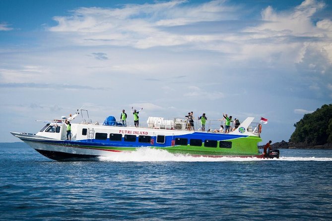
Ticket Prices for Fast Boat from Bali to Lombok
- Ticket from Padangbai Bali to Bangsal Lombok: Rp 250,000 per person, one way
- Ticket from Bangsal Lombok to Padangbai Bali: Rp 280,000 per person, one way
- Round trip ticket (return): Rp 500,000 per person
- Shuttle service prices in Bali: Rp 50,000 per person, one way, and Rp 100,000 per person, round trip
Temporary departure schedule post-Covid-19 pandemic:
- From Padangbai Bali: 09:30 AM WITA (Central Indonesian Time)
- From Gili Trawangan: 11:30 AM WITA
- From Gili Air: 11:45 AM WITA
- From Gili Meno: 12:00 PM WITA
From Bangsal Lombok: 12:00 PM WITA Terms and Conditions for Fast Boat Tickets:
- Prices apply to both foreign nationals (WNA) and Indonesian citizens (WNI)
- Infants (below 3 years old): Free of charge
- Children above 3 years old are subject to normal ticket fees
- One seat per passenger, except for infants below 3 years old
- Includes sea travel insurance from PT. Jasa Raharja
- Shuttle service covers Kuta, Seminyak, Sanur, central Canggu, central Ubud, central Jimbaran, and ITDC Nusa Dua.
4. From Lembar, take a minibus to Mataram. From Mandalika Terminal in Lombok, take an elf minibus that usually stops at Aikmel Market. From the market, continue with a pick-up service to Sembalun.
5. From Lombok International Airport: Take a Damri bus to Mataram’s bus terminal. Then continue with a traditional Lombok public transport called “engkol” or find transportation to Aikmel Village and then to Sembalun.
Information & Tips:
- Ferry fare Padang Bai – Lembar: Approximately IDR 50,000 (4 hours)
- Fastboat fare Padang Bai – Teluk Nara/Bangsal Harbor: Approximately IDR 300,000 to IDR 450,000
- Minibus fare Lembar – Mataram: Approximately IDR 20,000
- Mataram – Sembalun fare: Approximately IDR 15,000 (1 hour)
- Open cabin Car Aikmel – Sembalun fare: Approximately IDR 25,000
- Bus fare Damri – Mataram: Approximately IDR 30,000
- Engkel (traditional Lombok transport) Mataram – Sembalun fare: Approximately IDR 20,000
If you want a more comfortable option, you can charter a car at Lombok Airport that will take you to the Sembalun trekking post with a fare of approximately IDR 500,000, accommodating 7 to 8 people. You can also rent a minibus for approximately IDR 700,000, which can accommodate up to 15 people.
The travel time is about 3 hours. When returning from Senaru, there is no public transportation available, so you have to take a motorcycle taxi (ojek) to the engkol crossing point or an elf vehicle heading to Mataram. The ojek fare is approximately IDR 25,000, and the engkol fare is approximately IDR 30,000 (3 hours).
If you want to rent a vehicle to go to Mataram, you can look for car rentals at tourist information or nearby homestays.”
Mount Rinjani Trekking Route Map:

Upon arrival at the basecamp, you can take a short break or fulfill your logistical needs. In this basecamp area, you can also find guides and porters if needed. (Note: The times on the map indicate normal trekking times).
Mount Rinjani Trek:
-
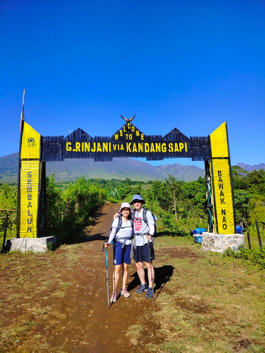
Basecamp – Post 1: The trekking route to Mount Rinjani initially passes through rice fields and local farmland. As far as the eye can see, there are only grasslands surrounded by hills. “Meadow heat and some cows, enjoy it.” Until reaching post 1, the trail consists of vast and hot grasslands, but it provides a refreshing sight. After crossing a bridge with dried-up water and directional signs towards post 1, it indicates that post 1 is nearby.

-
Post 1 – Post 2: The journey from post 1 to post 2 takes a long time with a slightly uphill trek and occasional shady spots with trees where you can rest from the scorching heat. There is a shelter in the middle of the vast grassland where you can rest. Post 2 is located near a bridge and can be used as a camping site due to its spaciousness, flat terrain, and a water source. Toilets have also been built around Post 2. This is because the initial trekking route still consists of open savannah grassland.

-
Post 2 – Plawangan (Crater Rim): The trek from post 2 to Plawangan is quite far and physically demanding. The trail continues to ascend with compact soil mixed with large rocks. The scarcity of trees makes the climb even more challenging. To reach Plawangan, you must pass through 7 shaded hills that are quite exhausting, and you need to replenish a lot of energy. When you reach near the river, there is a shelter near a cave where you can rest. After that, the Mount Rinjani trekking trail continues with an uphill trek on solid and dusty soil until you reach Plawangan. Plawangan is the last post on Mount Rinjani before reaching the summit, and it offers an awesome spot to enjoy the natural scenery. Segara Anakan is already visible from here. The best camping spot is to continue climbing following the trekking route towards the left. In that area, you will be close to a water source and the route towards Segara Anakan, also known as the Senaru gate route. There, the peak of Mount Rinjani stands tall with its beautifully lined slopes.

-
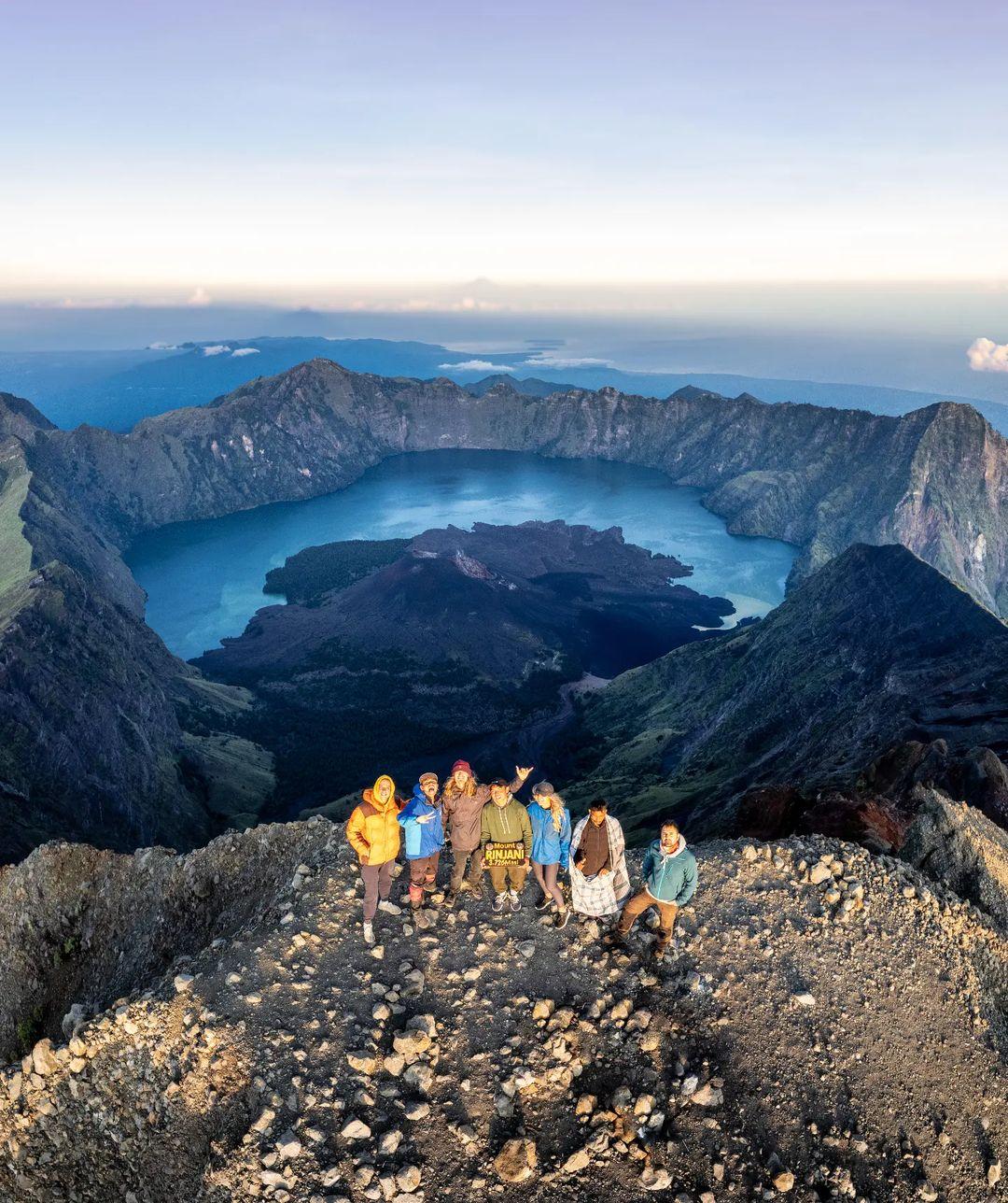
Plawangan (Crater Rim) – Mount Rinjani Summit: It is best to start the summit trek to Mount Rinjani early in the morning to catch the sunrise. The trek to the Rinjani Summit consists of winding paths of compact sand. The long stretch of solid soil marks the vegetation boundary. In this area, strong winds mix with cold air, and it is prone to night storms. Large rocks are rarely found for shelter during storms. However, as you climb higher, there are long and wide rocks that can provide shelter. Next, you will encounter a sandy trail with thicker sand waiting for you. This sandy trail is quite long and physically demanding. So, don’t forget to bring sufficient supplies. Unlike the straight uphill sandy trail of Mount Semeru, there are two bends that need to be traversed to reach the summit of Mount Rinjani. Take it slow and don’t give up. Here, the view of Mount Rinjani’s slopes is beautiful. Edelweiss flowers grow on the left slope, and Segara Anakan is on the right, surrounded by the captivating slopes of Mount Rinjani. After passing a large rock, the summit of Mount Rinjani is getting closer. What a beautiful view from the highest mountain in West Nusa Tenggara! Upon reaching the summit of Mount Rinjani, you will see a row of mountains in the Rinjani National Park, Segara Anakan with its bluish water, and Segara Muncar. Segara Muncar is a dry caldera located across from Segara Anak. From a distance, you can also see Mount Agung, the highest mountain on the island of Bali, appearing small amidst the sea of clouds.

-
Sembalun Crater Rim to Segara Anak Lake: It doesn’t take long to return to Plawangan. The sandy trail makes it easier to descend quickly, although it can be very dusty. To descend via Senaru, the journey continues by descending to Segara Anakan first. There is a path on the left at Plawangan that leads to Segara Anak. This trail is quite steep, consisting of rocky terrain surrounded by dense trees. After reaching the bottom of the hill, the trail becomes steep and flat, indicating that you are nearing Segara Anak. Here, you can feel the quietness, silence, clarity, and freshness. Lake Segara Anak on Mount Rinjani is located at an altitude of 2,010 meters above sea level. It is considered beautiful, and the area around the lake provides a refreshing breeze after the exhausting climb. This is the perfect place to set up tents as the view of the lake is suitable for relaxation and unwinding. At this lake, anyone can go fishing, swimming, cooking, and search for water supplies. There are water sources around Lake Segara Anak Lake, and there are also hot springs that climbers usually use to clean themselves or take a swim. So, which do you prefer, warm water or cold water?
-
Segara Anak Lake to Post 2 Senaru: Descending through the Senaru gate requires descending to Lake Segara Anakan and then climbing again over the hills that border the lake. Even after leaving the area of Lake Segara Anak, the beautiful natural panorama of Rinjani still captivates, making you not feel too eager to leave. Along the hiking trail, Segara Anak is still clearly visible with the backdrop of Rinjani’s peak, forming a beautiful natural landscape. Sometimes, when starting the descent, it feels reluctant to go home. After being entertained by the beautiful panorama as a farewell gesture, you reach the beginning of suffering. The trail goes uphill through a dense forest. The path along the cliff edge is the most tiring trek as it requires going up again to descend to the Senaru gate. The terrain consists of large rocks with long iron fences as boundaries. Upon reaching the top, another hill will come into view, which needs to be climbed using the same trail, quite draining one’s energy. The surrounding views during the journey will compensate for all the fatigue until reaching the final hilltop. At the top of the last hill, you will see the Teletubbies hills. In this rocky and grassy area, you can also set up tents at several flat spots. The descent is quite steep to reach Post 2 Senaru, with the trail surrounded by large trees and having to pass through tree roots protruding from the ground and stretching along the path.
-
Post 2 Senaru to Bas Rinjani Basecamp: The descent to the basecamp of Mount Rinjani via Senaru from Post 2 is on a gentle trail. It only takes about 2 hours to reach the entrance of the Senaru hiking trail. At the Senaru gate, there are stalls and huts to rest and satisfy your hunger after a long climb.
Tips for Climbing Mount Rinjani via Sembalun-Senaru:
- Use complete mountain climbing equipment and gear for comfort and safety.
- Registration for Rinjani is mandatory and can be done online through the eRinjani website or application.
- The quota for Mount Rinjani climbers is limited: Sembalun (150 people), Timbanuh (100 people), Senaru (150 people), Aik Berik (100 people). Only 500 people are allowed to climb Mount Rinjani per day.
- Guides and porters can be found in the basecamp area, but it is recommended to book them well in advance.
- There are shops around the basecamp to fulfill logistics needs.
- It is advisable to start the climb in the morning as the initial hilly trail can be very hot under clear weather.
- Follow the three signs on the hiking trail: Red (dangerous, do not linger on the trail), Yellow (can stop briefly for photos but not for too long), and Blue (safe and suitable for camping).
- Strategic camping locations are available at Post 2, Plawangan, and Segara Anakan, where water sources can be found.
- Use safety equipment during the summit. Bring trekking poles and gaiters to facilitate hiking on sandy trails.
- Be cautious of storms in the Mount Rinjani area. If a storm occurs, stop the climb or take temporary shelter behind wide rocks along the slope.
- Be careful when ascending, at the peak, and during descent. Avoid actions that could cause accidents.
- The descent trail from Plawangan to Segara Anakan is quite steep, so caution is required.
- Do not litter the Segara Anakan area and avoid polluting the water sources there as they have vital functions for climbers and the surrounding community (Sasak people).
- It is recommended to start the descent from Segara Anakan to Senaru in the morning as the trek is quite long.
- Prepare yourself physically as it will be an uphill descent that requires a lot of energy.
- Bring your trash down. Do not litter in the Mount Rinjani area or engage in vandalism.

